I had originally set out to complete this as a solo adventure over 3 days, but when my brother asked if he could join me and raise money for the Motor Neurone Disease Association, the adventure took on a whole new dimension.

In August 2020, Cycling UK officially launched 'The King Alfred’s Way', a 220 mile off-road cycle route, beautifully detailed in a paperback and down-loadable guidebook. The guide provides a fantastic background to the rich history surrounding the area, details about the route, suggestions on itinerary and what to expect on the way.
We’d elected to ride our cross-country mountain bikes in a bikepacking set-up and split the route over four days, camping for two nights with a hotel stay mid-point in Reading.

Day 1 – Winchester to All Cannings
We arrived in Winchester, parked, unloaded and were passing through the ancient "Westgate" by nine thirty. Winchester is a pretty city, its centre full of cobbled side streets and pavement café’s, all with that air of quiet longevity that a medieval city exudes. As we wound our way through the leafy suburbs, stopping occasionally for the usual beginning-of-the-ride-faff - to tighten a bike bag or remove a layer - the wide residential roads quickly turned to gravel track and open farmland.


It had been a wet summer so far and our four-day adventure didn’t look to buck the current weather trend. Rain was forecast (again), as if there wasn’t enough in the myriad of puddles that littered the trails, and our bikes were soon clagged with mud and our gears grinding under the lack of lubrication. Although it was wet, it was still warm. The kind of weather where you don’t mind riding through the rain in a jersey rather than donning the boil-in-a-bag waterproof.


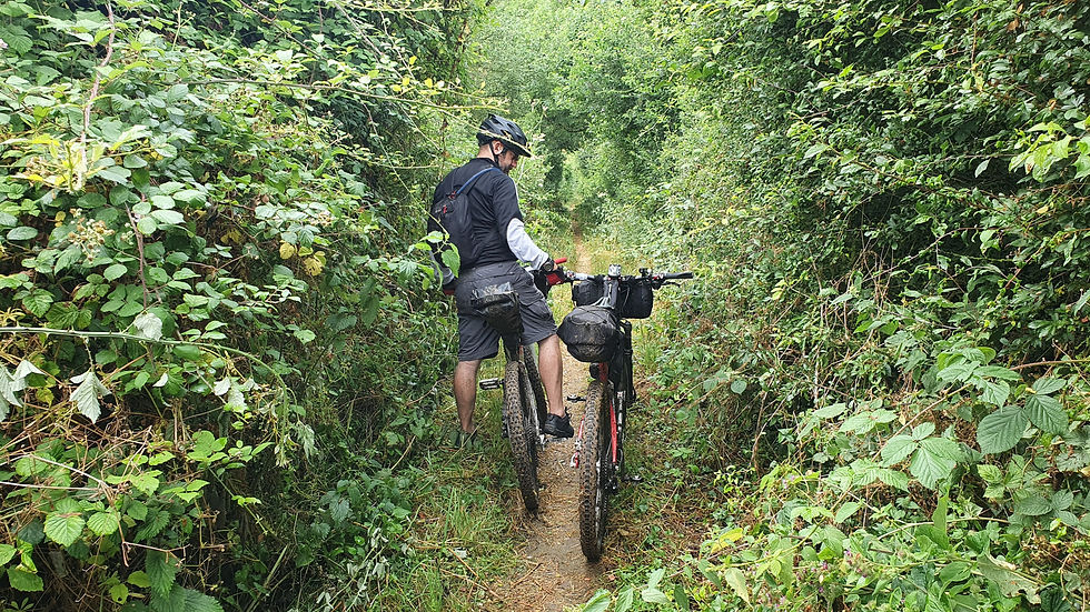
Continuing west through King’s Somborne, we passed a couple of joggers who warned us of an overgrown path up ahead..Not only had the wet summer brought mud to otherwise dry trails, the path side vegetation was wild and heavily overgrown and in some places impassable. And coupled with the weight of the moist air, the nettles and brambles drooped low across the path like claws; scratching, biting and stinging us as we gingerly picked our way down the Monarch Way old Roman road.
Finally free from the lacerating confines of the narrow path, we made a quick detour into Salisbury to grab some food then back up the hill for lunch at the Old Sarum Hill Fort.
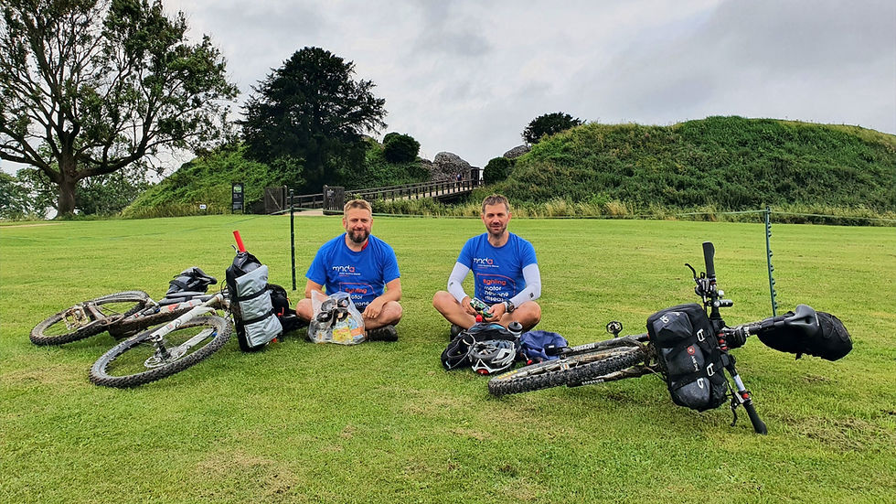

After the hill, the route turned northward along the Pewsey Avon Trail and parts of National Cycle Network route 45 up towards Stonehenge. And with it brought a welcomed dose of warm sun and a break in the cloud. It wasn’t our plan to stop here but a brief look at the ancient stones from the non-paying side of the boundary fence was enough to satisfy our cultural appetite for the day.

Onwards, past the traveller’s vans and army camp at Larkhill, brought us to the edge of the British Army’s training area on Salisbury Plain, it’s ominous “DANGER” signs firmly warning us of the imminent hazards of crossing the virtual boundary.


It was relatively good riding from here on, skirting the edge of the plain, the route alternating from tarmac perimeter road to expansive rolling crop fields with broad open skies. We dropped off the ridge at Market Lavington to stock up on food for dinner, then back on route passing through Chirton and Patney all the while acutely conscious of the black clouds gathering just off to the east.
We knew the rain would catch up with us at some point, it had been menacing us all day. But when it came, it was like an unsuspecting wave, a brief rush of cold air against the surrounding humidity and then the full force of the heavens burst upon us. We were soaked through within a minute, the chestnut trees we’d optimistically taken shelter under at the side of the road offering scant protection as we watched the road flood and water stream off into the already overflowing gutters.


We decided to ride on, the rain still relentless, arriving at our campsite just outside All Cannings, drenched, cold and definitely not looking forward to pitching our shelter. A neighbouring family in a camper van took pity on us as we struggled with the tarp and kindly offered us a cup of tea and handful of biscuits.

Shivering, but now under cover, we slipped on dry clothes and got dinner on the go. Chicken Pot Noodles, Scotch eggs and pork pies! The rain continued well into the night but that now seamed a world away as we sat cocooned in our sleeping bags and shared a dram or two of Scotland’s finest.
Day 2 - All Cannings to Reading
The morning started by donning wet clothes, wet shoes, putting away our wet shelter and pretty much anything else with the word “wet” in it. Dark clouds still dominated the horizon but as they scuttled across the sky, occassional optimistic shafts of sunlight streaked out from behind, with the tease of better weather to come.

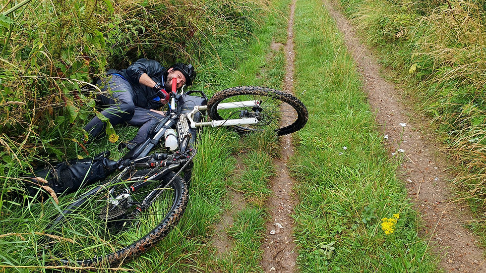
The route started with a steep climb into the clouds and up onto the White Horse Trail, then a long descent down into Avebury. It’s worth noting that The King Alfred’s Way, being a relatively new cycle route, has yet to ‘wear-in’. Combined with the overgrown path-side vegetation, a good percentage of the trails are literally a six-inch wide rut down the middle of a grassy strip and more fool the rider who gets their front wheel stuck in the groove and can’t hold their nerve!
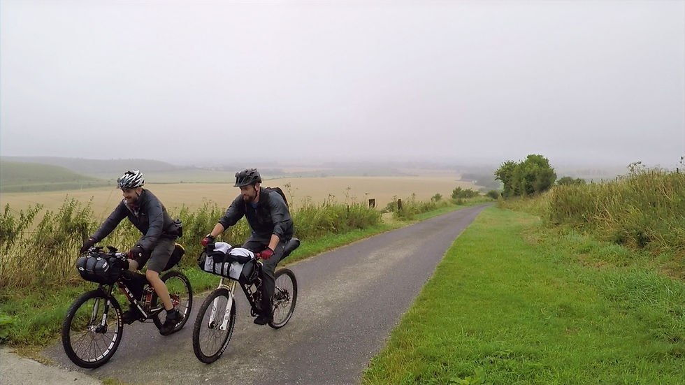
After breakfast in Avebury and a quick visit to our second set of ancient stones, The Avebury Ring, we climbed up onto the Ridgeway, a trail that would pretty much be our companion for the majority of the day (or so we thought...)
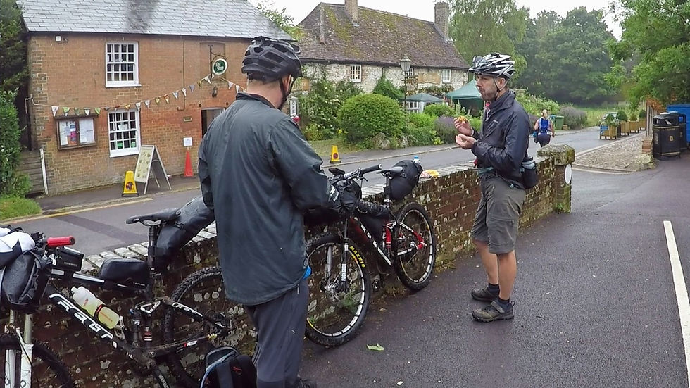

We were devoid of views across the valleys either side due to the low cloud, but the wide track perched on the chalk ridge was decent enough and initially made for good going. Barbury Castle came and went, silent in the mist, Smeathe’s Ridge could well have been at the bottom of a valley for all we could see and we would have missed Ogbourne St. George had we not purposefully decided to stop there.

The problem we were facing at this point was our generally slow progress. Some parts of the Ridgeway were so overgrown and so rutted that hikers were travelling faster than we were and our average speed at this point was around 4 mph. Fine if we had all the time in the world, but we still had forty miles to go and a reservation in the pub for dinner at 6pm!
It’s at times like this that experience prevails and being able to adapt the route to suit the circumstances is more important than blindly following what the guidebook says. As a result, we dropped off of the Ridgeway and progressed via the parallel road to try and catch up lost time, an action that paid off over the following twenty miles allowing us to get back on schedule and re-join the Ridgeway just after Wantage. Which, coincidentally, made for a great place to stop for a late lunch sitting on King Alfred’s statue in the town centre!

The Ridgeway is a stunning section, full of ancient history, littered with hill forts, barrows, hill side carvings (The White Horse) and pockets of woodland evoking images of long past travellers camping out keeping watch for local bandits or packs of roving wolves.
The sun finally came out as we passed through the towns of Streatley and Goring, either side of a natural gap in the ridge worn by the River Thames, marking the end of the Ridgeway for us.

We’d been heading east ever since the White Horse at Uffington and our route now switched to paralleling the Thames for the run into Reading. For a riverside trail it was surprisingly hilly but encouraged by the thought of a warm shower and a pub meal, now re-arranged for 8pm, we cruised into the Premier Inn in Reading with an hour to spare.


Day 3 – Reading to Hindhead
The grey clouds, both figurately and literally had lifted by this point and the ride southwards out of Reading was a marked improvement on the previous two days. Blue skies, warm sun and an interesting mix of urban sprawl, industrial expansion, wooded single track and quiet country lanes lasted for most of the morning as we wound our way towards Farnham.


We stopped for lunch at a recently opened café, its shabby chic styling drawing us in after the somewhat alluring sign outside the pub next door. Refuelled we pressed on to Farnham the chalk terrain now firmly swapped for sand as we passed through heathland, plantations, commons and parks, the convoluted route necessitating constant checking of the GPS at every junction.


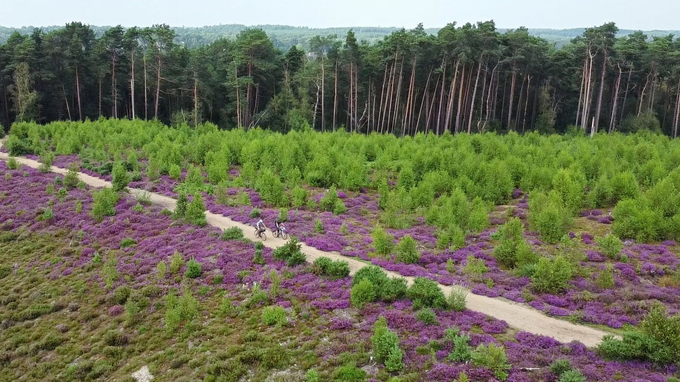
Heathland is some of my favourite terrain and the heady scent of Scots Pines coupled with a sea of purple heather was absolutely stunning as we picked our way up onto Frensham Common. And it repeated itself twice more as we passed through Hankley and Thursley Commons a few miles further on.

Hindhead has been totally transformed since the tunnel was built. What was once a bottleneck on the A3, it’s pretty shop fronts dirty from the constant stop-start vehicle traffic, has now become a beautiful town; its eastern end cul-de-sac’ed by the Devils Punchbowl and surrounding common.
Our plans for accommodation were fairly loose for day three, we were definitely camping but had left the final booking until a day previous and plans for an evening meal were still not set.
We opted for pub grub again and after confirming our camp site booking and asking for pub recommendations, we began a tour of the local hostelries in search for food and beer. After passing two pubs, one that was shut and one that was not serving food, we eventually ended up in The Deers Hut, three miles past our campsite!


Back at the campsite, our bellies full of beer and burgers, we pitched our tarp in the shelter of a glamping cabin, showered and hit the sack for the last night of our adventure.
Day 4 – Hindhead to Winchester
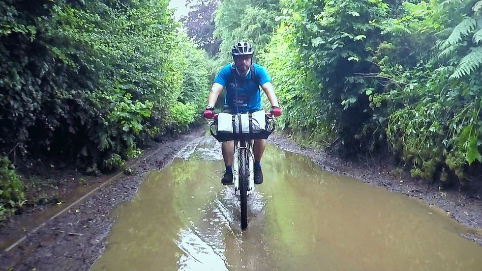
Another torrential downpour overnight ensured the trails were wet once again. Dodging the puddles only meant we brushed past the - now expected - stinging nettles, wet bracken and brambles, opening up old wounds and soaking our feet for the fourth day running. Our route was westwards now and on the home straight back to Winchester, so these minor inconveniences really didn’t matter anymore and we could just enjoy the riding and look forward to the fourth section of the route, the South Downs.


Breakfast first though, and a quick internet search alerted us to a 5 star cycle café pretty much en-route and a supermarket to stock up for lunch later on.
It’s worth pointing out that this entire Cycle UK route purposefully circumvents most urban establishments meaning you’ll need to deviate off route to get food and water. If you’re used to road riding or National Cycle Network routes then please don’t expect to just come across somewhere to stop and eat or even refill your water bottle!


We picked up the South Downs at South Harting and were quickly closing in on the Queen Elizabeth Country Park and Butser Hill. There’s some cracking MTB routes in the Country Park and Autumn brings a stunning swathe of gold across the valley as the Beech trees shed their green foliage. But for now, the middle of (our wet) summer, we were greeted with a dark canopy, flinty tracks the now customary wet chalk.

As we emerged next to the visitor centre our brakes smoking from the steep decent, we could hear the rumble of the London to Portsmouth road and could see the steep hill to come in the distance.
The underpass takes you safely to the other side of the A3 and onwards to the bottom of the long steep grassy slope of Butser Hill. There’s no shame in walking and it also gave us the chance to stop and admire the view, chat to walkers on the way and save our legs for the remaining twenty miles.


We stopped for lunch and a cup of tea at the top before re-joining the South Downs ridge and cruising west again. There’s a similarity between the Ridgeway and the South Downs, they’re both chalk / flint trails, which undulate across the landscape with fantastic views all round, the South Downs having the advantage (in my opinion) of facilitating stunning views across the English Channel to the south if you’re not in the cloud.
This was the hilliest day, six climbs in all, but we were on the closing stretch so didn't mind using up our remaining leg power knowing we didn't have to ride the next day.


There’s a fantastic moment as you crest the hill at Twyford Down where all of a sudden Winchester comes into view, its cathedral spires rising proudly above the surrounding city. It was a poignant moment as we not only admired the view but reflected on the last four days, the first of them seeming a lifetime ago now.

We finally arrived in Winchester at around 7pm, limbs aching, saddle sore, scratched and bruised as we posed for the obligatory photo next to King Alfred’s statue. A couple of guys wandered over keen to pick our brains about our journey. It turned out they were starting the route the next day and given the filthy state of our bikes were concerned about whether their gravel bikes were up to the job!


It's an amazing route and one we'd both have no hesitancy recommending to anyone looking for a cracking multiday adventure!
Tips for bikepacking The King Alfred's Way
Route:
220miles (355km), 4550m total ascent (approx.)
The route starts and finishes in Winchester which has good connections for both road and rail.
There are no public signs for this route (as you might find for National Cycle Network trail) so you will need a GPS or map for direction finding.
Day 1 – Winchester to All Cannings - 59 miles (95km), 1030m ascent, 3 x C5 climbs.
Winchester, Sparsholt, King’s Somborne, Houghton, Broughton, Middle Winterslow, Old Sarum Hill Fort - Salisbury, Amesbury, Stonehenge/Larkhill, (Salisbury Plain), Orcheston, Tilshead, Market Lavington, All Cannings.
Day 2 – All Cannings to Reading - 58 miles (93 km), 1055m ascent, 5 x C5 climbs.
All Cannings to Reading. All Cannings, Alling Down, B'hmpton & Avebury, (Ridgeway), Barbury Hill, Ogborne St. George, Foxhill, Uffington Castle (White Horse), Streatley & Goring, (Thames Path), Whitchurch-on-Thames, Reading
Day 3 – Reading to Bramshott Common - 55 miles (87km), 835m ascent, 3 x C5 climbs.
Reading, Riseley, Crockham Village, Ewshot, Farnham, Frensham Common, Hankley Common, Thursley Common, Hindhead Common, Hindhead, Bramshott Common.
Day 4 – Bramshott Common to Winchester - 46 miles (73km), 1035 ascent, 5 x C5 climbs.
Bramshott, Weavers Down, Liss, (South Downs Way), Queen Elizabeth Country Park, Butser Hill, Old Winchester Hill, Exton, Cheesefoot Head, Winchester.
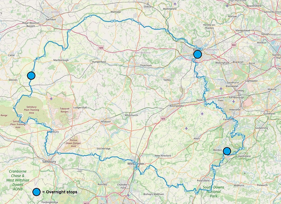
The attachment below is a .gpx file of the entire route without detours for overnight stops. Please feel free to download and modify to suit your own adventure accordingly. There is a version on the Cycling UK website which features route notes alongside each waypoint but I found this was incompatible with my Garmin GPS.
Accommodation:
Day 1 – Little Owls Camping, 3 South Farm, All Cannings, Devizes, Wiltshire, SN10 3JX. https://www.littleowlscamping.co.uk/
Day 2 – Premier Inn Reading (Caversham Bridge) hotel, Richfield Avenue, Reading, Berks RG1 8EQ. https://www.premierinn.com/gb/en/hotels/england/berkshire/reading/reading-caversham-bridge.html
Day 3 – Old Barn Farm Camping, Hewshott Lane, Liphook, GU30 7SY. http://www.oldbarnfarm.estate/
Eating:
I haven't included any of the local shops we used for general supplies on route as these can be found in most villages. The list below contains the main places we stopped for an "eat-in" meal.
Toby Carvery Caversham Bridge, Reading. https://www.tobycarvery.co.uk/restaurants/south-east/cavershambridgereading
Nibbles Café, The St, Crookham Village, Fleet GU51 5SJ
The Deers Hut (Pub), Longmoor Rd, Griggs Green, Liphook GU30 7PD https://thedeershutpub.co.uk/
Turtle Bean cafe, 41-43 Station Rd, Liss GU33 7DP https://turtlebeancafe.co.uk/
Equipment:
Felt Edict, full suspension mountain bike, running Maxxis Ardent 2.25 tyres
Bikepacking bags: Self-made bar bag (15ltr), Topeak seat pack (16ltr), self-made frame bag (3ltrs), Topeak top tube bag (0.5ltr), Evoc Hip Pack Pro (3ltr)
Sleeping: Tarp, ground sheet, Bug bivi, sleeping bag, inflatable mattress and pillow
Cycling clothes: Helmet, gloves, glasses, cycling shoes, padded cycling shorts, zip off trousers, wool t-shirt, short sleeve shirt, arm warmers, neck buff, windproof smock.
Spare clothes: Down gilet, light weight fleece, zip off trouser legs, socks, underwear, waterproof jacket
Wash kit, towel and first aid items
Collapsible seat and sit mat
Stove, gas, mug, spork
Food
Head torch, multitool
Mobile phone, GPS, GoPro, Drone, battery(s), charger, cables
Bike tools, innertube, pump, lights
Notes:
Guide Book
The Cycling UK guidebook is an excellent resource, providing a huge amount of information on the terrain, bike, kit, navigation, safety and the historical aspects of the entire route. It also provides useful considerations on how many days to break the route into and where to stay along the way. The guide can be downloaded here: https://www.cyclinguk.org/king-alfreds-way
Bike choice
This is definitely not a National Cycle Network Route. The guidebook says it's an off-road route, which I'd agree with, and they also suggest it can be ridden on a gravel bike - to which I'd have mixed thoughts. Two significant considerations will be the weather and the amount of equipment you’re intending to take.
Weather - if the weather has been good over the preceding weeks and the trails are dry at the time of your trip then a gravel bike is fine. If you're attempting the route in Spring or Autumn (or even Winter), or when the trails are wet, I would definitely recommend a MTB.
Equipment weight - If you're planning to self cater the whole way and your bike is loaded up with bags and gear then I'd suggest a MTB is the better choice.
The terrain is quite varied: there’s plenty of chalk, which when wet is like ice and always mixed with tyre slashing flint. The earth over Salisbury is a kind of clay / gravel mix that clogs your tyres and throws up small sharp rocks. The heathland around Hindhead has wide tracks of 'wash-out inducing' sand. Much of the first 120 miles crosses washboard corrugated farm land and a good percentage of tracks are just generally muddy bridleways.
The flip side to this are beautiful quiet country lanes, dusty single track and loamy wooded trails.
Whatever bike you look to take, you’ll need a low gear ratio for the hills, wide tyres with a thick casing to protect from the sharp flint, a decent grip for wet chalk and mud and plenty of volume to iron out the washboard terrain.
We both rode full suspension cross country mountain bikes and they were perfect. I locked out my rear suspension for a couple of days as I was suffering from some bag rub, so would suggest a hard tail MTB is a good choice as well.
We met a fair few people on gravel bikes, none of whom were camping / carrying camping gear.
Parking in Winchester
Car parking facilities in Winchester are not great as most car parks only allow up to 24 hr parking. I did read that some people have 'fed the meter', remotely via an app for a number of 24hr periods, but the car park terms and conditions suggested I may be returning to a parking ticket if I tried to extend the stay past the maximum single visit.
You could park outside the city itself and then cycle a mile or so to the start. We found a Premier Inn just on the outskirts that allowed us to park for the entire four days.
Distance vs days
The guide book contains some excellent information to help you to work out how many days you should break the journey into. We chose four days of approximately 55 miles a day.
Obviously it all depends on your fitness, the weather / time of year, the amount of equipment you're carrying, whether you're camping or B&B'ing, even the amount of time you have available.
I would however offer a thought that perhaps day 2, All-Cannings, to Reading, is quite a long stretch for one day. If everything is on your side then it's perfectly doable. But, as we found, the trails were slow making it a very, very long day.

NJMCDirect is the most reliable platform for paying parking tickets and municipal violations in New Jersey. With its user-friendly and secure online system, NJMCDirect ensures quick resolutions, saving time and effort. Avoid the stress of handling fines manually—njmcdirect ticket search provides a clear and efficient way to manage tickets seamlessly. Avoid fines with NJMCDirect’s transparent platform, offering convenience similar to the preparation needed for multi-day adventures.